


![2024 Atlantic Hurricane Season Guide [Latest News]](http://www.jackery.com/cdn/shop/articles/2024_atlantic_hurricane_season.jpg?v=1721184100)
The 2024 Atlantic hurricane season is projected to be extremely active, with 17 - 25 storms. The NOAA forecasters are 70% confident that 8 - 13 storms will become hurricanes, including 4 - 7 major hurricanes. The above-normal activity of the Atlantic hurricane season is due to a confluence of factors, including near-record warm ocean temperatures in the Atlantic, reduced Atlantic trade winds, and the development of La Nina.
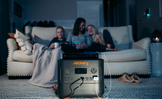
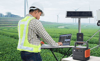
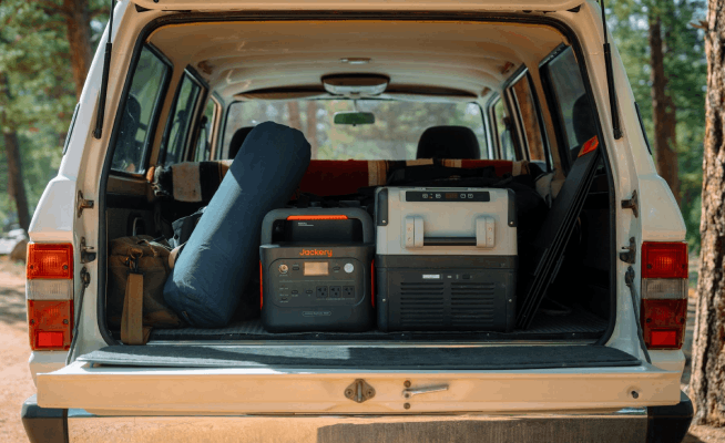
With hurricane season approaching, everyone should focus on gathering the essential items and preparing an emergency kit. You'll also need a portable and reliable solar-powered generator to power emergency items such as TVs, laptops, lights, smartphones, etc. Jackery Solar Generators are portable, compact, and powerful charging solutions that can power 99% of indoor or outdoor emergency appliances for hours.
Key Takeaways
- The 2024 Atlantic hurricane seasonspans from June 1 to November 30.
- Some 2024 Atlantic hurricane season storm names include Alberto, Beryl, Chris, Debby, Ernesto, Francine, Gordon, Helene, Isaac, Joyce, Kirk, etc.
- Hurricanes range from Category 1 - Category 5, with Category 5 being the most dangerous.
- Hurricanes can cause storm surges, tornadoes, winds, heavy rainfall, inland flooding, and rip currents.
- Preparing for hurricanes includes strengthening the home, staying connected, preparing an evacuation plan, and gathering emergency supplies.
Latest News About 2024 Atlantic Hurricane Season
According to AccuWeather, the Atlantic hurricane season is expected to approach its peak in September 2024. The meteorologists at AccuWeather predict around 6 - 10 tropical systems in September 2024, similar to the record-breaking 2020 hurricane season that had 10 September storms. The dramatic increase in tropical storms will start at the end of August and persist throughout September.
When asked about the US areas with maximum danger, AccuWeather Lead Hurricane Expert Alex DaSilva said, "I'm still very concerned about the Texas coast.” Carolina and Florida are at an elevated risk of a tropical storm or hurricane making landfall. However, the danger will extend far beyond where a storm makes landfall. It's predicted that not only will October remain busy, but there will be three storms in November.
When Is the 2024 Atlantic Hurricane Season
The NOAA National Weather Service forecasters predict above-normal hurricane activity in the Atlantic basin in 2024. According to the NOAA outlook, the 2024 Atlantic hurricane season, which spans from June 1 to November 30, predicts an 85% chance of an above-normal season, around 10% chance of a near-normal season, and a low 5% chance of a below-normal season.
NOAA is forecasting a total of 17 - 25 storms with a wind of 39 mph or higher. Out of these storms, 8 - 13 are predicted to become hurricanes with a wind of 74 mph or higher. Nearly 4 - 7 hurricanes will be major with winds of 111 mph or higher and category 3, 4, or 5. The 2024 Atlantic hurricane season is expected to have above-normal activity because of the near-record warm ocean temperatures in the Atlantic and the development of La Nina in the Pacific.

2024 Atlantic Hurricane Season Data & Resources
The 2024 Atlantic hurricane season is near as the La Nina and warmer-than-average ocean temperatures are driving tropical activity. The list of 2024 hurricanes ranges from Alberto to William and Beryl. Here is the list of storm names for 2024:
- Alberto
- Beryl
- Chris
- Debby
- Ernesto
- Francine
- Gordon
- Helene
- Isaac
- Joyce
- Kirk
- Leslie
- Milton
- Nadine
- Oscar
- Patty
- Rafael
- Sara
- Tara
- Valerie
- William
Alberto is the first named tropical storm of the 2024 season. It made landfall near Tampico, Mexico, and has caused heavy rainfall and strong winds in northeast Mexico and Texas.
Hurricane Beryl was the first hurricane of the 2024 Atlantic hurricane season that rapidly strengthened to a Category 5 storm. The exceptionally warm ocean temperatures were the key factors behind Category 5.
Experts have warned that the 2024 Atlantic hurricane season will be busier than the previous seasons. This is due to the potential development of La Nina in the Pacific mid-hurricane season and the warm tropical Atlantic, Gulf of Mexico, and Caribbean Sea.
Resources to Know More About 2024 Atlantic Hurricane Season
In order to know more about the 2024 Atlantic hurricane season and help everyone prepare for the unexpected events, here are the measures that will be implemented by NOAA in 2024:
Enhanced Communications
NOAA will implement various improvements in forecast communications, storm recovery effects, and decision support. For example, the National Hurricane Center (NHC) will expand the line of Spanish-language text products to include the Tropical Cyclone Update, the Public Advisories, the Tropical Cyclone Discussion, and Key Messages in the Atlantic basin.
NHC will issue an experimental version of the forecast cone graphic beginning on or around 15. It includes a depiction of inland tropical storms and even hurricane watches and warnings. This graphic will help communicate inland hazards during tropical cyclone events without over-complicating the current version. If any updates are required to watches and warnings for storm surges or winds, the NHC will be able to notify the public in an intermediate advisory.
New Tools for Hurricane and Forecasting
In 2024, the two forecast models, including the Modular Ocean Model or MOM6, will be operational and added to the Hurricane Analysis and Forecast System. They will help the public understand the driving factors of hurricane intensity. The SDCON will predict the probability of rapid intensification of tropical cyclones.
NOAA's new generation of Flood Inundation Mapping will provide information to water and emergency managers. The detailed information will help authorities prepare and respond to potential flooding and find better ways to protect people and infrastructure. In 2024, NOAA, in partnership with NHC, will issue an experimental rainfall graphic for Central America and the Caribbean.
System Upgrades
NOAA will upgrade the systems that help understand and forecast hurricanes. The National Data Buoy Center of NOAA recently upgraded many coastal weather buoys in the tropical western Caribbean and Atlantic. The main aim behind the upgrade is to include the time of occurrence and measurement of one-minute wind speed and direction.
With the help of the Directional Wave Spectra Drifters (DWSDs), NOAA will gather additional observations about the uncrewed surface vehicles, which will be deployed at the start of the hurricane season. The DWSDs will provide one-minute data in real-time. A new lightweight drop sonde called Streamsonde will be deployed into tropical storms to collect multiple real-time observations and valuable wind data.
Categories of Hurricanes
The Saffir Simpson Hurricane Wind Scale is a 1-5 rating depending on the hurricane's sustained wind speed. It typically estimates the potential property damage. Generally, category 1 and 2 storms are dangerous and require preventative measures. Category 3 and higher are highly dangerous because of their potential for significant damage to life and property.
Category 1: The wind speed is between 74 and 95 mph. These dangerous winds can damage well-constructed house frames, roofs, shingles, gutters, and vinyl siding. Large tree branches can also fall, damaging power lines and poles and leaving residents without power.
Category 2: The extremely dangerous winds blowing at 96 - 110 mph will cause extensive damage. They can damage roofs and siding even if there are well-constructed home frames. The shallowly rooted trees can fall and block the roads. Residents can also expect power outages that might last several days to weeks.
Category 3: The wind speed is around 111 - 129 mph and can cause devastating damage. The well-built will homes can cause major damage or removal of gable ends or roof decking. Trees might block the roads, and basic utilities like water and electricity might not be available for several days or weeks.
Category 4: Winds blowing at 130 - 156 mph can cause catastrophic damage. The heavy winds can cause severe damage to well-built home frames and loss of roof structure and exterior walls. During Category 4 hurricanes, fallen trees and power poles can isolate residential areas. You can expect power outages to last for weeks to months.
Category 5: Hurricanes have strong winds blowing at 157 mph or higher, which can cause catastrophic damage. They can destroy well-built houses with total roof failure and collapse. Similar to Category 4 consequences, strong hurricanes can damage power lines and cut the electricity supply for weeks or months.
|
Category |
Note |
|
Category 1 |
● Winds blow at 74 - 95 mph and a storm surge of 4 - 5 feet above normal tide. ● Damage is caused to poorly constructed buildings, trees, shrubbery, and unanchored mobile homes. ● Low-lying coastal roads are flooded. |
|
Category 2 |
● Winds blow at 96 - 110 mph and a storm surge of 9 - 12 feet above normal tide. ● Damage is caused to buildings' roofing materials and exposed mobile homes. ● Low-lying escape and coastal roads become impassable by rising water. |
|
Category 3 |
● Winds blow at 111 - 129 mph and a storm surge of 9 to 12 feet above normal tide. ● Large trees blow down, mobile homes are destroyed, and damage is caused to roofing materials. ● Severe flooding is caused at the coast, and large structures are damaged by debris and waves. |
|
Category 4 |
● Winds blow at 130 - 156 mph and a storm surge of 13 - 18 feet above normal tide. ● Trees and shrubs will blow down, causing extensive damage to roofing materials, windows, and doors. ● Flat terrains 15 feet or less above sea level will be flooded inland as far as six miles. ● Major damage will be caused to the lower floors of structures near the shore. |
|
Category 5 |
● Winds blow greater than 156 mph, and storms surge over 18 feet above normal tide. ● Trees and shrubs will be blown down, and building roofs will be damaged. ● Complete building and roof failures, along with the destruction of mobile homes. ● Residential areas on low ground within 5 - 10 miles of shore need to be evacuated. |
Hazard Risks of Hurricanes
Hurricanes can cause tremendous damage to coastal cities, towns, and even the natural environment along the coast. However, the amount of damage will directly depend on the strength of the storm and what it impacts. Understanding the hazard risks of hurricanes will help you prepare better and make an informed decision about what actions to take.
Storm Surge
Storm surge is an abnormal water rise generated by strong winds. A storm moving towards the coastline can raise the sea level by 20 - 30 feet. The floods caused by storm surges can demolish docks, roads, and houses and erode beaches. They can often last for a short time—just a few hours—but cause a lot of damage. SLOSH (Sea, Lake, and Overland Surges from Hurricanes) is a computer model that is used to predict how much storm surge will occur.
Inland Flooding
After hitting the coastline, the hurricane travels inland. While it typically weakens at this point, it can still cause damage. Torrential rains can cause rivers to flood the banks and mudslides to form. If the hurricane is approaching the area where you live, consider making a hurricane safety checklist with the essential items and evacuate to a safe location. When approaching water on a roadway, you'll need to remember, "Turn Around, Don't Drown."
Winds
Tropical-storm-force winds are strong and dangerous to those caught in them. They can destroy mobile homes and buildings, turn down power lines and trees, and damage roofing. The winds associated with hurricanes are intense near the center of the storm. When the winds move inward, they rapidly decrease, and hurricane-force winds can be felt as far as 150 miles inland.
Tornadoes
Tropical storms and hurricanes can also produce tornadoes, which occur in thunderstorms embedded in rain bands. These tornadoes are produced by relatively weak and short-lived tropical cyclones that pose a significant threat.
Heavy Rainfall
Heavy rainfall can cause flooding in inland areas. While rainfall is not directly related to the strength of tropical cyclones, it is influenced by the speed and size of the storm. Slow-moving and large storms generate more rainfall than fast-moving and smaller ones.
Rip Currents
The tropical cyclone's strong winds can lead to dangerous waves, posing a significant threat to coastal residents and mariners. Rip currents are like the channeled currents of water flowing away from shore and can even pull the strongest swimmers away from the shore.
How to Prepare for A Hurricane
Preparing for hurricanes involves strengthening the home, staying connected, making an evacuation plan, keeping emergency supplies handy, and having hurricane insurance. However, climate change causes hurricanes to strengthen faster and lead to heavier rainfall. Here are some of the best hurricane preparation tips from the American Red Cross, National Weather Service, Texas General Land Office, and Ready.gov.
Strengthen Your Home
You should secure items outside that can easily be picked up by high winds, such as trash cans and lawn furniture. If there are trees surrounding the property that can fall on the home in heavy rainfall or strong winds, consider trimming them out. Heavy winds and rainfall can enter your home, so make sure to protect it with permanent storm shutters or pre-cut plywood.
Stay Informed
The National Weather Service sends alerts and warnings to the residents with the NOAA Weather Radio (NWR). You should consider signing up for emergency alerts and notifications that the community may offer. Here are a few terms you should understand about NOAA:
Tropical Storm or Hurricane Advisory: When the NWS expects conditions that might be inconvenient for the residents, they issue an advisory. If caution is used, these situations can easily be tackled.
Tropical Storm or Hurricane Watch: If the tropical storm or hurricane is expected within 48 hours, NWS issues a Watch. You should tune in to NOAA Weather Radio All Hazards, TV, local radio, or new sources to get updated information.
Tropical Storm or Hurricane Warning: The NWS will issue a Warning when the hurricane can be expected within 36 hours. You should complete your hurricane preparation and immediately evacuate the area if the local authorities say so during this time.
Evacuation Plan
If the authorities order you to evacuate your home, grab the emergency kit and leave immediately. You need to bring an evacuation kit, including food, water, medicines, a safety first aid kit, a smartphone, and a portable power station.
If you are looking for a safer solar-powered generator that can keep essential appliances, such as smartphones, lights, etc., charged on the go, you may consider investing in the Jackery Solar Generators. They are compact in size and feature a large battery capacity, so you can pack them in the vehicle and charge emergency gadgets whenever needed.
Emergency Supplies
You should gather emergency items such as food, water, and medicine. Ideally, you should organize supplies in a Go Kit and a Stay-at-Home Kit. A Go Kit should include chargers for your devices, such as CPAP, cell phones, etc. You should also have a small portable power station that can charge electronics on the go.
In addition, you can prepare a Stay-at-Home Kit with two weeks of supplies since hurricanes can cause stores and pharmacies to close. Whether you're preparing a Go-Kit or a Stay-at-Home Kit, you'll need a reliable solar-powered generator like Jackery Solar Generator. It can charge TVs, radios, or smartphones to receive updates from the official authorities.
Communication Plan
You should sign up for free emergency alerts from the local government and plan to monitor local weather and news. You need a backup battery or a way to charge the cell phones and a battery-powered radio to receive updates from power outages.
Your family may not be together during a hurricane, so everyone should know how to communicate with one another in case of an emergency. Keep the essential numbers written in the wallet, especially for situations when you might not be able to access the contact list on the phone. You should also designate an out-of-town contact who can help all the family members reconnect.
Hurricane Insurance
You should check if your homeowner's insurance covers the expenses of temporary damage caused by a hurricane. Most homeowner's insurance policies don't cover flood or hurricane insurance. It's better to consider investing in flood insurance, which will help you recover faster.
Important Documents & Items
You would also need to keep all the essential documents and items protected from the flood water. For example, pack the home's documents and insurance before planning to evacuate the place.

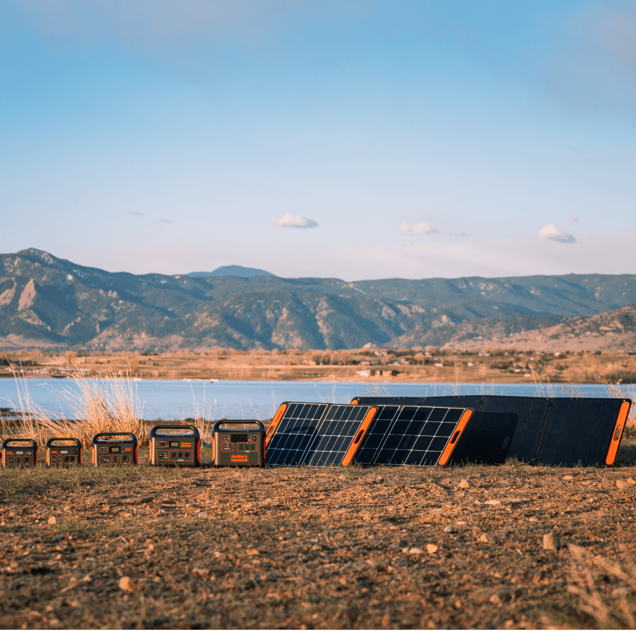
Jackery Solar Generators for Emergencies
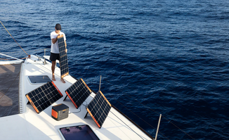
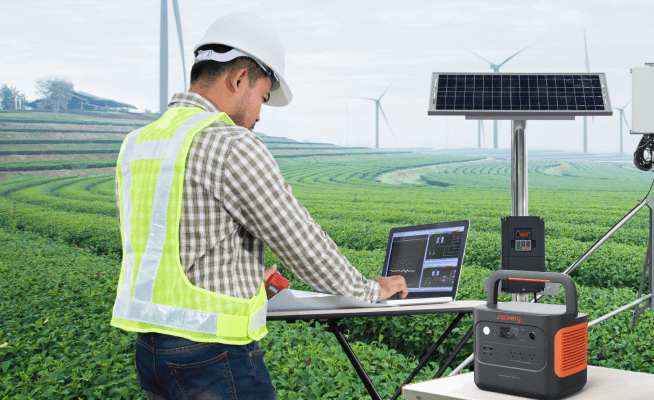
When a hurricane occurs or the local authorities have issued hurricane alerts in the coming days, you'll need a reliable and eco-friendly solar generator that harnesses the free solar energy to generate electricity. Jackery is a renowned and reputable solar brand that manufactures solar panels, portable power stations, and solar generators.
When placed under direct sun's rays, the solar panels absorb solar rays and generate DC electricity. The generated electricity is then passed to the pure sine wave inverter to produce AC electricity. You can plug emergency appliances, such as smartphones, TVs, lights, etc., into the output ports of the portable power station to charge them.
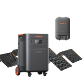
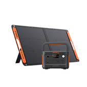
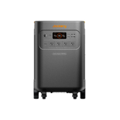
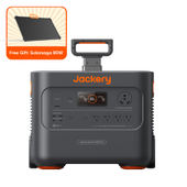
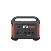
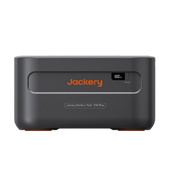
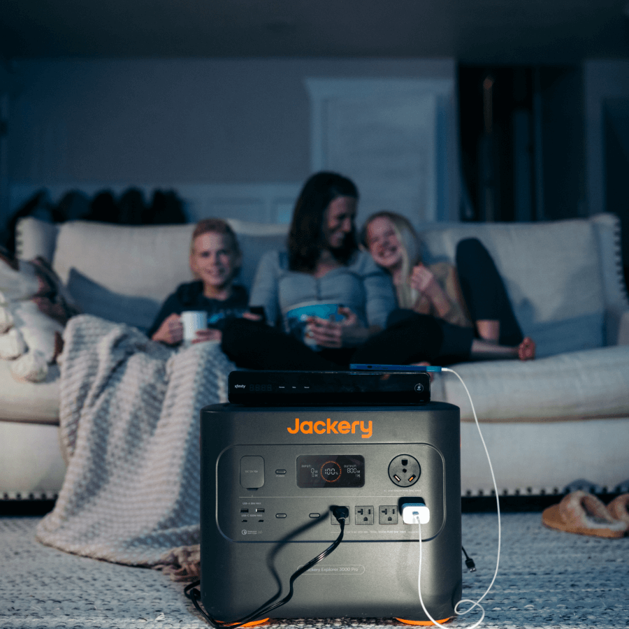
Jackery Solar Generator 3000 Pro
If you live in an area with extended power outages due to hurricanes or other emergencies, you may consider investing in the Jackery Solar Generator 3000 Pro. The large battery capacity and portable design ensure that you can move the solar-powered generator to charge emergency gadgets wherever required. For example, the solar generator can charge your TV and smartphone so you can receive the latest information about hurricanes during a power outage.
Appliances Running Time
- Portable Refrigerator (60W) = 42.8H
- TV (150W) = 17.1H
- Induction Cooktop (1100W) = 2.3H
- Smartphone (20W) = 128.5H
- Portable Fan (50W) = 51.4H

Customer Review
"I recently got an in-home consultation for a built-in generator estimate. While I wanted to prepare for hurricane season, I was not ready to pay $15K for a generator and installation. The Jackery 3000 Pro with solar panels meets our needs and is a lot more economical, easy to use, and convenient to store." — Mark Zais.
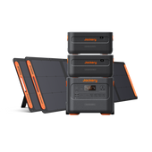
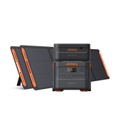
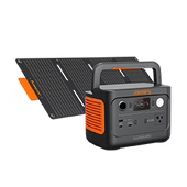
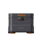
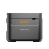
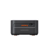
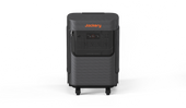
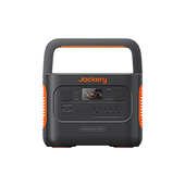
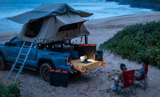
Jackery Solar Generator 2000 Plus
The Jackery Solar Generator 2000 Plus is another expandable solar-powered generator that can charge 99% of emergency appliances at home or outdoors. The pull rods, double wheels, and ergonomic design make it easy to store the solar generator in the vehicle if a bug-out situation arises. For instance, you can charge small air coolers, lights, laptops, TVs, and CPAP machines for long hours.
Appliances Running Time
- Portable Refrigerator (60W) = 28.9H
- TV (150W) = 11.5H
- Induction Cooktop (1100W) = 1.5H
- Smartphone (20W) = 86.8H
- Portable Fan (50W) = 34.7H

Customer Review
"Very good quality, the battery lasts a very long time. Very easy to move around with the built in tires. Love the upgrade ability. Best solar generator I have ever had." — Marc.
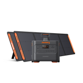
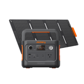
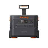
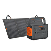
Jackery Solar Generator 1000 v2
The Jackery Solar Generator 1000 v2 is a smaller, stronger solar-powered generator that can charge most essential appliances for long hours. Its remarkably high output can run low- to high-power appliances such as refrigerators, portable fans, lights, and smartphones. It weighs only 24.2 lbs and can easily fit in the rear compartment of the bug-out vehicle.
Appliances Running Time
- Portable Refrigerator (60W) = 15.1H
- TV (150W) = 6.0H
- Induction Cooktop (1100W) = 49 minutes
- Smartphone (20W) = 45.4H
- Portable Fan (50W) = 18.1H

Customer Review
"I bought the Explorer 1000 v2 for a long road trip as an emergency tool. Well, it didn't take long to figure out if I could plug in a small fan and clip it to the back seat and keep the dogs in their crates cool in the cargo area." — Susan.
What To Do During & After A Hurricane
If the authorities order to evacuate the area prone to hurricane damage, grab the Go Kit and leave immediately. However, if you live in an area that is not in the mandatory evacuation zone, you may still decide to leave for a safer location or stay in your home.
During the Hurricane
When hurricanes hit the area nearby or where you are staying, you need to prepare and find a safe shelter.
Tips for Staying At Home Safely
If you plan to stay home, you'll need to be ready to live without power, water, phone, gas, and internet for a long time. Here are some hurricane preparation tips to follow when staying at home:
- Stay indoors and move away from glass doors and windows. If you are in a temporary structure, consider moving to a sturdy building or a windowless room that is not likely to flood.
- If you are in an area prone to flooding, move to higher grounds before flood water reaches you.
- Do not use a gas generator, grills, camp stoves, charcoal burning device, gasoline-powered equipment, etc., inside the home or in a partially enclosed area.
Tips for Evacuation
If you're in an area where local authorities have ordered you to evacuate, you can follow the necessary tips to follow the evacuation plan:
- Grab your Go Bag Kit and leave immediately. You should consider following the evacuation routes the authorities offer and avoid taking any shortcuts.
- Plan the evacuation routes in advance and keep all your family members informed.
- You can download the Red Cross Emergency App to find evacuation shelters near you.
After the Hurricane
If you've evacuated to a safe location, do not return until the local authorities say the area is safe and you have the necessary supplies. If hurricane-force winds have damaged your residential property, it should be inspected and cleaned before moving.
How to Stay Safe
Here are some safety tips to follow once you're back home after the hurricane:
- You should not wade in floodwaters as they might contain dangerous debris, such as metal, glass, dead animals, gasoline, oil, or downed power lines.
- Avoid entering the building until the officials have thoroughly inspected the damage caused to electrical systems, gas lines, septic systems, water lines, or wells.
- If the electrical equipment is wet or is standing in the water, make sure to maintain a safe distance.
- If there is a power outage, use battery-powered lanterns or flashlights to reduce the risk.
How to Clean Up
When executing the post-hurricane clean-up, you'll need to use appropriate protective equipment to avoid possible injury. Some personal protective gear you would need include gloves, N95 masks, and rubber boots.
- Open the doors and windows to remove the air.
- Move out mattresses, upholstered items, and other saturated porous materials with visible fungal growth.
- Tear out paneling, flooring, insulation, drywall, and electrical outlets that have been saturated by floodwater.
- Properly clean and disinfect remaining debris and mud.
- Dry out the building and other remaining contents.
- Work with a partner if you are cleaning heavy debris.
Post Mental Health Recovery
After the hurricane hits the area, it's normal to feel many emotions. The best way to return to normal life is to eat healthy food and get enough sleep to deal with the stress. You can also call or text the Disaster Distress Helpline at 1-800-985-5990 to talk with someone for free.
2024 Atlantic Hurricane Season FAQs
What size of solar generator do I need for an emergency?
The size of the solar generator needed for an emergency like a hurricane depends on the total wattage of all the appliances used simultaneously and for how long you want to charge them. For example, let's say the official authorities have issued a hurricane watch in your area, but there is a power outage.
In that case, you'll need a reliable charging solution to charge a TV, smartphone, CPAP machine, and other emergency appliances. If you are using the Jackery Solar Generator 3000 Pro to charge a TV (150W), smartphone (20W), portable fan (50W), and lights (20W) at the same time, the working hours of the solar-powered generator can be calculated as follows:
Working Hours = Battery Capacity in Wh × 0.85 ÷ Operating Wattage of the Appliances = 3024Wh × 0.85 ÷ 240W = 10.7H.
Note: The multiplication with 0.85 is because there will be some loss when charging the appliances.
Will there be a hurricane in Florida in 2024?
NOAA has predicted above-normal hurricane activity in the 2024 Atlantic hurricane season, with 17 - 25 named storms. Of these, 8 - 13 could become hurricanes, including 4 - 7 major ones.
How far in advance do we know about hurricanes?
Scientists usually notify the hurricane path for 3-5 days in advance. The possible trajectory of the hurricane is represented as a cone that shrinks with time as the prediction error decreases.
When to avoid Florida hurricane season?
While hurricanes can occur anytime during Florida's hurricane season, they are most likely to occur from mid-August through late October. The official peak of the Florida hurricane season is September 10.
Are there warning signs before a hurricane?
The first signs of a hurricane appear, including ocean surface swells of 10 - 15 feet, light breezes, falling pressures, and white cirrus clouds on the horizon. Before 24 hours, you'll see overcast skies, sea foam on the ocean's surface, and high winds.
Final Thoughts
The forecasters at the Climate Prediction Center of the NOAA National Weather Service have predicted above-normal 2024 Atlantic hurricane season. Residents need to prepare for hurricanes well in advance and gather essential supplies, such as water, food, medicines, and a power source. This is because you might lose access to essential utilities during hurricanes.
If you live in an area where hurricanes can impact the quality of living, it's better to invest in a reliable solar-powered generator. Jackery Solar Generators, for example, have a large capacity and can charge most emergency appliances for long hours. They are compact and portable enough to be carried in the vehicle for evacuation during hurricanes.
Are you ready for the 2024 Atlantic hurricane season with the essential items by your side? If so, let us know what appliances you prefer to have during such emergencies and how you charge them.


Leave a comment